


121JC01 - JC01 Voting District, Fulton County, Georgia
About
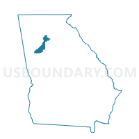
Outline

Summary
| Unique Area Identifier | 561560 |
| Name | 121JC01 - JC01 Voting District |
| County | Fulton County |
| State | Georgia |
| Area (square miles) | 4.76 |
| Land Area (square miles) | 4.67 |
| Water Area (square miles) | 0.09 |
| % of Land Area | 98.18 |
| % of Water Area | 1.82 |
| Latitude of the Internal Point | 34.03764150 |
| Longtitude of the Internal Point | -84.13869550 |
Maps


Graphs
Select a template below for downloading or customizing gragh for 121JC01 - JC01 Voting District, Fulton County, Georgia


Neighbors
Neighoring Voting District (by Name) Neighboring Voting District on the Map
- 11717 - 17 JOHNS CREEK Voting District, Forsyth County, GA
- 11719 - 19 OLD ATLANTA Voting District, Forsyth County, GA
- 11731 - 31 SAINT MARLO Voting District, Forsyth County, GA
- 121JC02 - JC02 Voting District, Fulton County, GA
- 121JC06 - JC06 Voting District, Fulton County, GA
- 121JC07 - JC07 Voting District, Fulton County, GA
- 135007 - DULUTH A Voting District, Gwinnett County, GA
- 135111 - DULUTH H Voting District, Gwinnett County, GA
- 135155 - SUWANEE G Voting District, Gwinnett County, GA
- 135162 - SUWANEE H Voting District, Gwinnett County, GA
Top 10 Neighboring County Subdivision (by Population) Neighboring County Subdivision on the Map
- Roswell-Alpharetta CCD, Fulton County, GA (255,812)
- Suwanee-Duluth CCD, Gwinnett County, GA (93,976)
- Big Creek CCD, Forsyth County, GA (53,346)
Top 10 Neighboring Place (by Population) Neighboring Place on the Map
Top 10 Neighboring Unified School District (by Population) Neighboring Unified School District on the Map
- Gwinnett County School District, GA (793,941)
- Fulton County School District, GA (528,870)
- Forsyth County School District, GA (175,511)
Top 10 Neighboring State Legislative District Lower Chamber (by Population) Neighboring State Legislative District Lower Chamber on the Map
- State House District 98, GA (84,580)
- State House District 24, GA (80,448)
- State House District 97, GA (61,275)
- State House District 50, GA (59,352)
Top 10 Neighboring State Legislative District Upper Chamber (by Population) Neighboring State Legislative District Upper Chamber on the Map
- State Senate District 27, GA (264,822)
- State Senate District 45, GA (256,939)
- State Senate District 48, GA (198,933)
Top 10 Neighboring 111th Congressional District (by Population) Neighboring 111th Congressional District on the Map
Top 10 Neighboring Census Tract (by Population) Neighboring Census Tract on the Map
- Census Tract 502.12, Gwinnett County, GA (11,749)
- Census Tract 116.23, Fulton County, GA (11,473)
- Census Tract 116.22, Fulton County, GA (9,625)
- Census Tract 116.26, Fulton County, GA (8,047)
- Census Tract 502.14, Gwinnett County, GA (7,777)
- Census Tract 1306.08, Forsyth County, GA (4,599)
- Census Tract 1306.10, Forsyth County, GA (4,230)
- Census Tract 502.05, Gwinnett County, GA (3,749)